- EarthCache
- GC2179V
- by MountainNinja
- Location:
- Thailand
- N 08° 16.522′ E 098° 30.033′
You may have heard your geocaching pals crack jokes about how a particular cache made them feel like Indiana Jones, James Bond, or some other heroic adventurer—but this Geocache of the Week in Thailand gives that concept a whole new meaning.
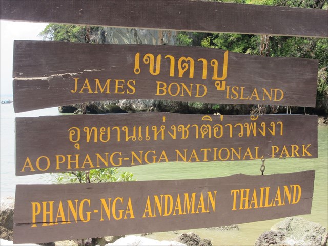
GC2179V Ko Tapu – James Bond Island isn’t trying to fool you with its name. The scene of this EarthCache, Ko Tapu, is a dramatic, rocky islet that sits in Phang-Nga Bay, Thailand, and was one of the backdrops featured in 1974’s The Man with the Golden Gun. The Bond film is such a tourist attraction that the island across from Ko Tapu has been unofficially renamed—as the sign shows below, Khao Phing Kan is now ‘James Bond Island.’

Not only has Ko Tapu captured the interest of James Bond-lovers everywhere, the strange monolith rock formation has also been the subject of an amazing EarthCache since November 2009, when geocacher MountainNinja published GC2179V to honor the natural beauty of the location. The EarthCache has been logged nearly 1,000 times, accumulating an impressive 157 Favorite points, which makes it Thailand’s most-Favorited cache of all time.

Given the popularity of this EarthCache, it may come as a surprise that it carries the highest possible terrain rating. The challenge of reaching this cache comes from the fact that James Bond Island can only be accessed by boat. Since the area is such a hotbed for tourism, finding a boat ride out to the island may not be as challenging as one might expect. Speed boat rentals can take you from the mainland to Ko Tapu in about 40 minutes, or you can take the scenic route on one of Thailand’s famous long-tailed boats and explore the region’s magnificent limestone karsts.
However you plan on reaching James Bond Island, you’ll want to carve out a good portion of your day to bask in the idyllic beauty of this incredible location and complete the logging requirements for GC2179V. To claim this smiley, all you need to do is attach a photo of yourself with Ko Tapu in the background to your log and send a message to the owner approximating the height of the rock.

The longer you look at the rock, you may find yourself becoming increasingly perplexed. The monolithic rock formation stands upright with its impossibly narrow bottom tethered to the seawater below. Fascination grows as you notice the many plants and trees that decorate this strange islet. If you’re lucky enough, you might see a few of the 82 distinct exotic fish darting around in the turquoise water below.

On the way back to the mainland, you may realize that you have more questions than when you began this journey. How could such a beautiful landscape exist? Was that even real? What geological processes created those islets? For these questions, refer to the cache page where MountainNinja provides some explanation. Roughly 30 to 50 million years ago, tectonic movements in Southeast Asia caused widespread drainage of the seabed. Humid conditions and warm temperatures led to erosion of the region’s plentiful limestone, resulting in the bizarre karsts and islets we can observe today in Thailand and neighboring countries.
GC2179V reminds us of the mysterious ways in which our Earth creates its own beauty. It reminds us that you can’t rush perfection—30 million years isn’t much of a wait when this stunning landscape is the final product. Most importantly, it reminds us that we can all feel like James Bond while we’re out geocaching!

Continue to explore some of the most amazing geocaches around the world.
Check out all of the Geocaches of the Week on the Geocaching blog. If you would like to nominate a Geocache of the Week, fill out this form.
Source: Geocaching